
When it comes to Scottish Islands, Raasay is largely overlooked in favour of its more famous neighbour Skye. However, for hiking enthusiasts, there are plenty of beautiful walks on Raasay, if you know where to look!
If you’re looking for some great hikes on the Isle of Raasay, grab a wee dram and settle in. I’m going to outline all of the best trails, including their difficulty level and wow factor.
Related: (opens in new tab)
- Amazing Walks on the Isle of Skye
- Best Day Trips from the Isle of Skye
- Trotternish Loop: Skye’s Best Roadtrip!
5 Incredible Walks on the Isle of Raasay
1. Dùn Caan
- Length: 15.5 km/9.75 miles
- Duration: 5-6 hours
- Difficulty: Moderate
- Wow factor: ⭐⭐⭐⭐⭐
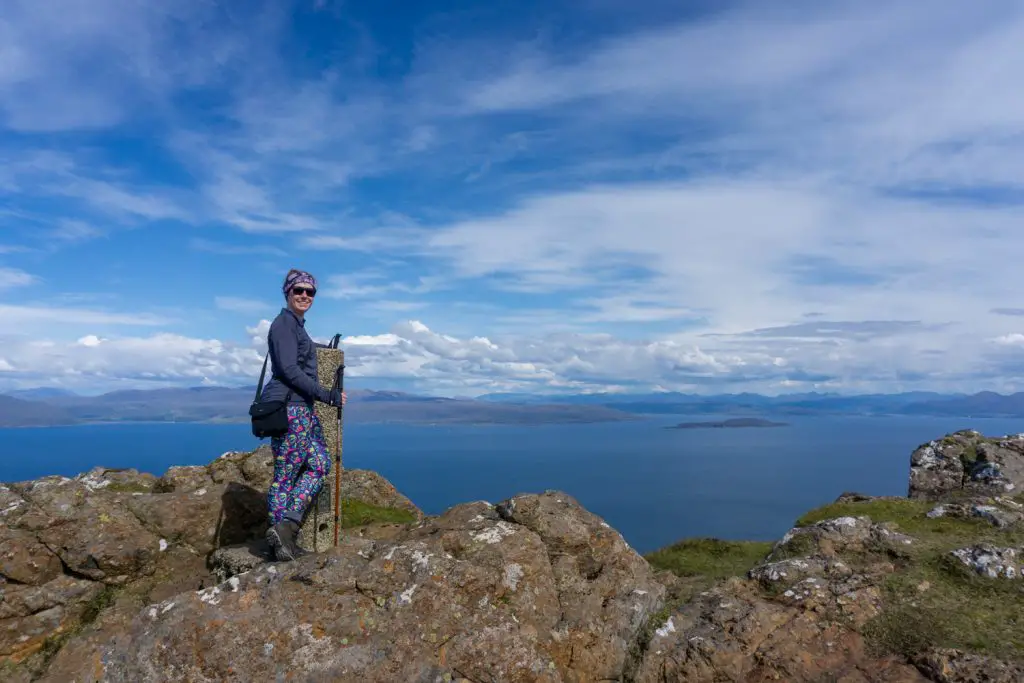
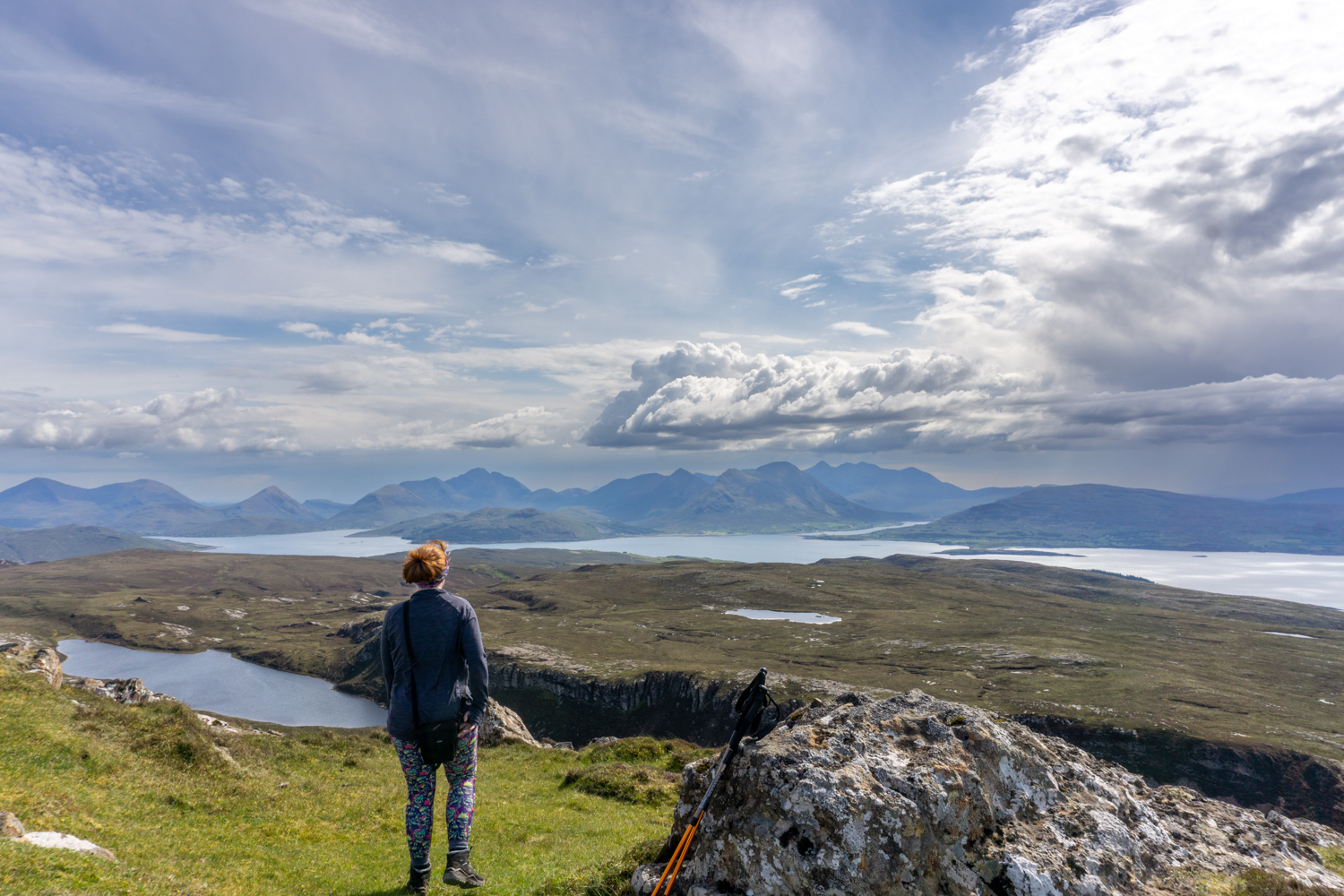
If you ask previous visitors which of the walks on Raasay they would most recommend, you could bet a shiny pound on most people saying Dùn Caan. This flat-topped hill is the standout feature of the island and is well worth the effort it takes to reach the top.
Unlike some of the hill walks on the neighbouring Isle of Skye, you don’t need to be an experienced scrambler to take on Dùn Caan. Although the hike is a little taxing, it is generally beginner-friendly. Even the more intense steep sections are not half as bad as they look at first sight.
Even though on this version of the walk, a substantial distance is covered, it is easy to pick up the trail from other points closer to the summit. This means that even if you have limited time on the island, you should still get the opportunity to summit Dùn Caan.
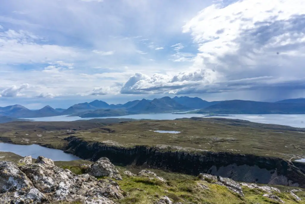
The views from the top of Dùn Caan are simply breathtaking, showcasing the mountain scenery of Skye’s east coast and offering sweeping vistas all the way back to the mainland of Scotland.
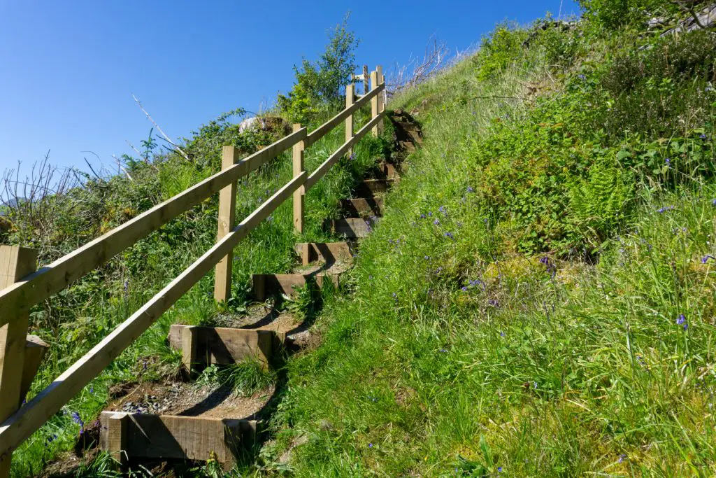
How to get there: If you are doing the full-length hike, you will begin from the ferry terminal. From there, follow the road until you reach a lane that heads to the right and then to the left. The hikes on Raasay are very clearly signed so keep an eye out for pointers and follow the established path.
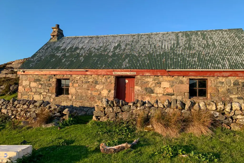
2. Taigh Thormoid Dhuibh
- Length: 4.8 km/3 miles
- Duration: 2-3 hours
- Difficulty: Moderate
- Wow factor: ⭐⭐⭐⭐
The walk to this beautifully remote bothy begins at the end of the road at Arnish. Although there are brief instructions on how to get there in the Bothy Bible, they are not very detailed and make the walk sound a lot easier than it is.
There are some steep parts on this hike which can be a little tricky to navigate if you are hiking with a full backpack. Still, the remote and wild landscape makes this trail well worth doing. Red deer are commonly spotted en route and you’re unlikely to share the bothy with many others, even if you visit during peak season.
In parts, the route all but disappears, especially when the ground gets very boggy. You are definitely recommended to wear waterproof socks and sturdy hiking boots for this trail!
As the path can be quite difficult to follow at certain points of the year, it is worth doing some research beforehand to make sure you have a good idea of where you need to go. Phone signal isn’t great along some parts of the route, so make sure you’ve downloaded any information you need in advance so that you can access it offline.
Bothies
Somewhat controversially, I have decided to include Taigh Thormoid Dhuibh bothy in this list. I know that writing about bothies online is frowned upon by many members of the hiking community, however, I want to explain my reasons for doing so. As somebody who developed a love for the outdoors later in life, I truly believe that these wild places should be accessible to everyone. And, if you don’t know about the existence of bothies, how can you enjoy them? I’m not going to provide a detailed route to Taigh Thormoid but if you’re new to bothies, there should be enough information here for you to begin your own research.
How to get there: To reach Taigh Thormoid Dhuibh, park in the small area at the top of Calum’s Road. From that point, take the signposted track to Torran. More directions can be found in the Bothy Bible (although these aren’t great) or elsewhere in the deep recesses of the internet.
3. Calum’s Road, Torran and Eilean Fladday
- Length: 5.5 km/ 3.4 miles
- Duration: 2 hours
- Difficulty: Easy
- Wow factor: ⭐⭐⭐
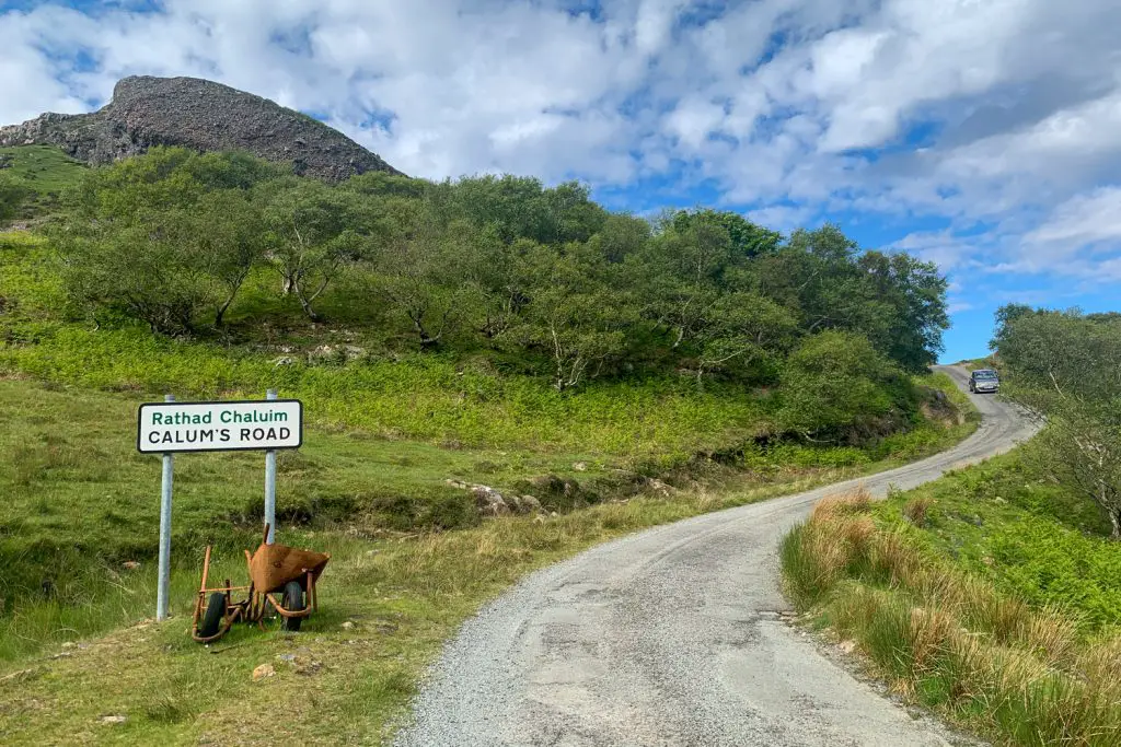
The story of Calum Macleod is an enchanting tale of what one man can achieve in the face of adversity. As well as charming visitors, the building of Calum’s Road brilliantly sums up the realities of living on a remote Scottish Island.
Crofter Calum lived in Arnish, the once isolated north end of Raasay. He had long been appealing to the local council, asking them to build a road from the village of Brochel to the north of the island. They repeatedly rejected his request and refusing to be beaten, Calum grabbed a wheelbarrow, pick and shovel and did the job himself. The road took around a decade to build and was later adopted and surfaced by the council.
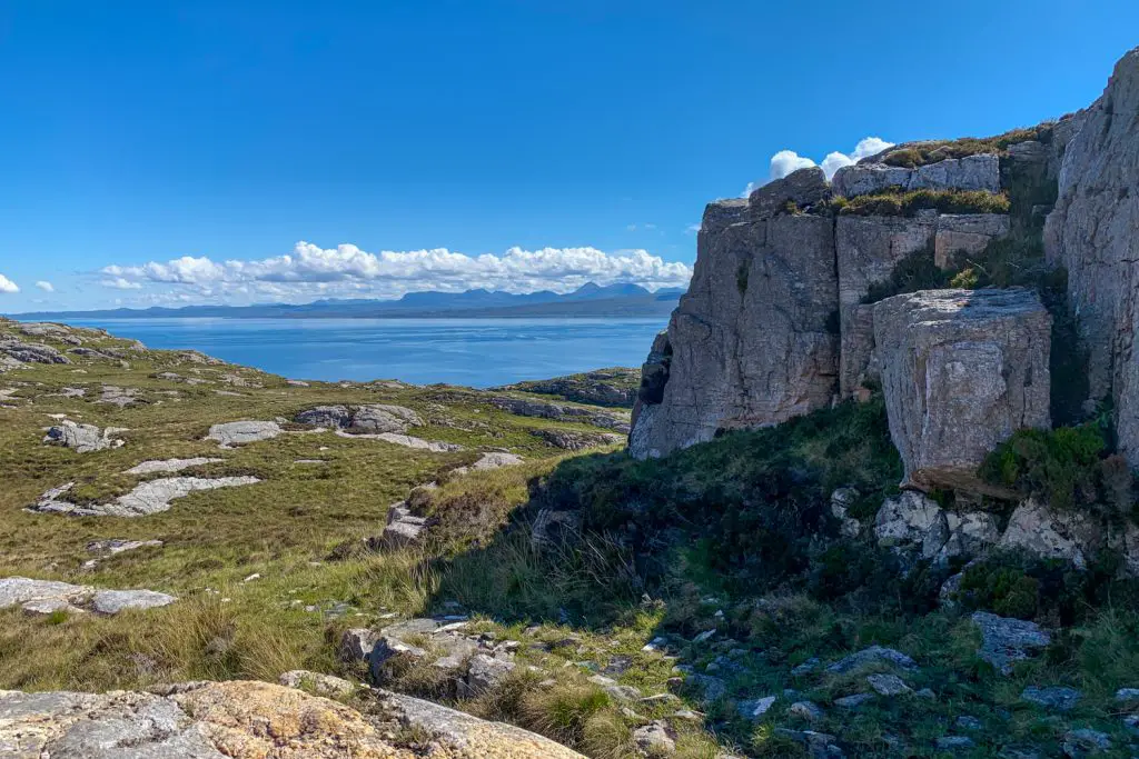
Although Calum’s Road is a fun road trip in its own right, there is also a nice circular walk which begins at the end of the road in Arnish. This walk around the north end of the island heads all the way to Eilean Fladday (Fladda). This tidal island is home to three inhabited houses (used as second homes) and can be reached via traversing the rocks at low tide. The walk is fairly easygoing and on a clear day, gives wonderful views out to the sea and towards the Isle of Skye’s Trotternish Ridge.
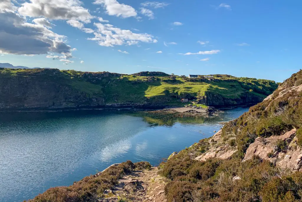
How to get there: Park at the endpoint of Calum’s Road in Arnish. There is space for three or four cars in this small parking area. From there, follow the signs to Fladday. Once you reach the island, you are free to explore – just make sure you check the tide times! The return route heads up a steep path close Fladday. Follow the trail back down from there.
4. Temptation Hill
- Length: 3.4 km/ 2 miles
- Duration: 1-1.5 hours
- Difficulty: Easy
- Wow factor: ⭐⭐⭐⭐
One of the Inverarish Forest walks, this hike up to Temptation Hill offers some of the best views on the island for the least effort. The trail is well signed (you’ll need to be following the red path) and the walk is usually included on the complimentary tourist information leaflets available at the ferry terminal.
This path is mostly made up of tarmac and gravel. There are steps up to Temptation Hill viewpoint but these are relatively few in number. Although there are some steep sections on this walk, the terrain makes this walk very doable for most.
When you reach the top of the hill, there is a bench from which to enjoy the views. If you pack ahead of time, it is well worth making a picnic to enjoy there on a good day. The views across the Sound of Raasay and towards Skye are stunning.
How to get here: This walk can be accessed from the No 1 Mine car park, close to Inverarish. From there, follow the red markers to Temptation Hill.
Midges
May to September is Highland Midge season in Scotland. These small biting insects plague the highlands and in particular, the west coast during this time, meaning they also frequent Raasay. Although they are not dangerous, their bite causes itchy red bumps. Your trip doesn’t have to be ruined by midges though, just remember to arm yourself with some Smidge to keep them at bay.
5. Churchton Bay and Inverarish
- Length: 6.5 km/ 4 miles
- Duration: 2-2.5 hours
- Difficulty: Easy
- Wow factor: ⭐⭐⭐⭐
This Raasay walk leaves straight from the ferry terminal and is a great jaunt, either when you arrive on the island or just before you leave. The hike is fairly easy, following waymarked paths for the duration. Although it doesn’t require heavy-duty footwear, it is worth noting that the woodland section can get quite muddy, especially after rain.
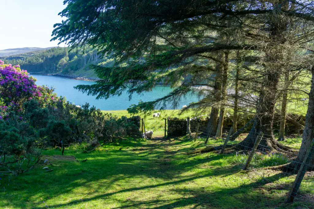
Arguably the most scenic section of the walk is the part that skirts around North Bay. The views over to Ben Tianavaig on Skye are beautiful from here on a clear day. There are also lots of nice places in this area to wild camp.
Much of this trail weaves through woodland and there is also the option to make a detour up to Temptation Hill if you still have life in your legs!
The final section of the walk goes through Raasay’s capital, Inverarish. This tiny village is packed full of character and you can stock up on (basic) supplies at the community-run shop there. The hike officially ends at Raasay Distillery which is a great stop in its own right. From there, it is easy to walk to Raasay House for a light lunch or dinner. If visiting for the latter, it is always advisable to book in advance.
How to get here: The trailhead begins at the ferry terminal, heading left behind the toilets. The trail is largely way marked and more detailed directions can be found on the free Raasay tourist information leaflet or Walk Highlands.
How to Get to the Isle of Raasay
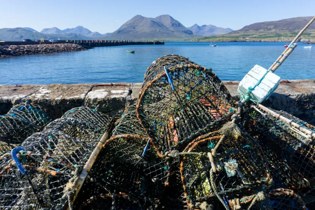
To get to the Isle of Raasay, catch the ferry from Sconser on Skye. The fares are very reasonable and you can either travel as a foot passenger or bring your car. Be aware that there is limited parking on Raasay which could fill quickly during the summer season.
Ferry tickets do not need to be purchased in advance and are sold on the boat. The journey one way takes around 25 minutes and a return ticket is valid for a week from the date of purchase.
See more information about the ferry from Skye to Raasay here.
Where to Stay on the Isle of Raasay
One of the most important things to know about the Isle of Raasay is that it sees far fewer visitors than neighbouring Skye. As such, there is much less infrastructure and fewer accommodation options. If you’re planning your visit and wondering where you should stay on Raasay, these are your main options. If you don’t mind roughing it, there is also the ability to wild camp pretty much anywhere on the island.
This post contains affiliate links. If you use them, I will receive a small commission at no extra cost to you.
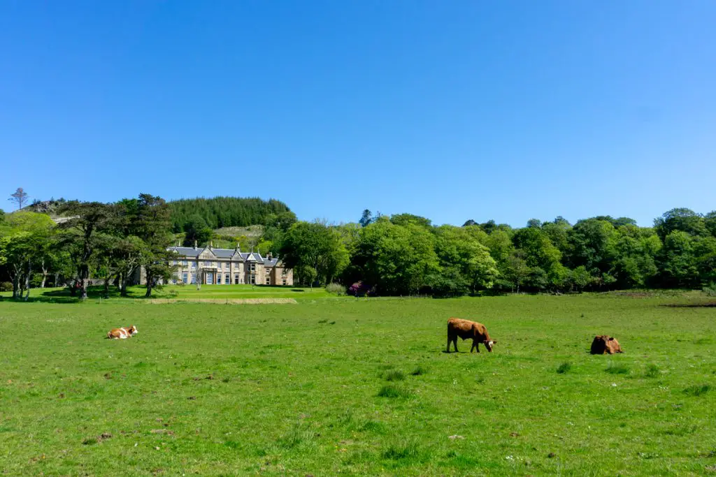
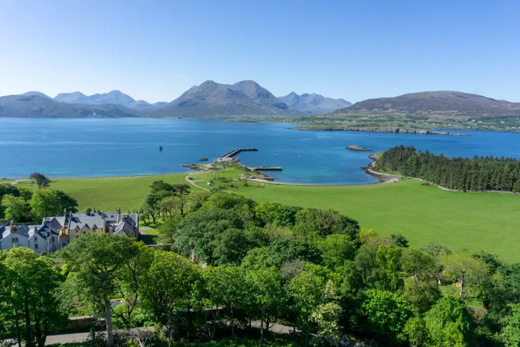
Raasay House Hotel (£££)
This Georgian mansion can be seen as soon as you disembark the ferry. Although once far more budget-friendly, Raasay House now markets itself as a luxury option and has the price tag to match. The huge bonus of staying here is your proximity to the in-house restaurant, the only one on the island.
Raasay Distillery (£££)
Offering adult-only accommodation, Raasay Distillery is the only place in Scotland where you can stay overnight in an operational distillery. Borodale House has been revamped to include six ensuite bedrooms, all with wonderful views.
Taigh Thormoid Dhuibh (FREE)
The bothy on the island is free for all to use. Officially, it can sleep six people, however, in reality, the floor space allows for many more than that. As with all bothies, if you use this rest stop, you should leave it in better condition than you found it. As this bothy is quite remote, you’ll need to bring all of your own supplies including your sleep system, water and fuel.
Have you visited the island yet? Which of these walks on Raasay is your favourite?
