
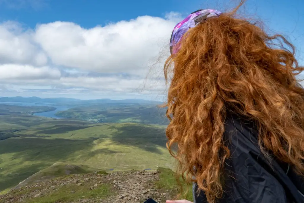
With so many amazing walks on the Isle of Skye, choosing the best can be a real challenge, especially if your time on the island is limited!
Since I began working here seasonally a few years ago, I’ve been hiking and exploring the island as much as possible. In the process, I’ve tackled many of the hikes on Skye and compiled a list of my favourites.
Making a shortlist has been challenging. There are so many epic trails to choose from! This list of the best walks on the Isle of Skye contains something to suit everyone, regardless of fitness ability.
Keep reading for my top picks, including details about hike duration, terrain and most importantly, the wow factor!
This post contains affiliate links. If you use them, I will receive a small commission at no extra cost to you.
Read more: (opens in new tab)
- Where to see Wildlife on the Isle of Skye
- Visiting the Isle of Skye in Winter
- Where to Stay on the Isle of Skye, Scotland
The Best Isle of Skye Hikes: Quick Answers!
- Best short hike: Old Man of Storr
- Best long hike: Point of Sleat
- Best hike for views: The Quiraing
- Most unusual hike: Spar Cave
- Best hike for beginners: Fairy Glen
- Best hike for experienced walkers: The Skye Trail
A Note About Midges…
Highland midges are rife on Skye and can make a hiker very miserable. If you want to avoid getting bitten by these buzzy insects where you can, make sure you check out this guide to midges in Scotland. From the ideal time of day to trek, terrains you want to avoid and the best repellent, it’s all in here.
15 Incredible Walks on the Isle of Skye
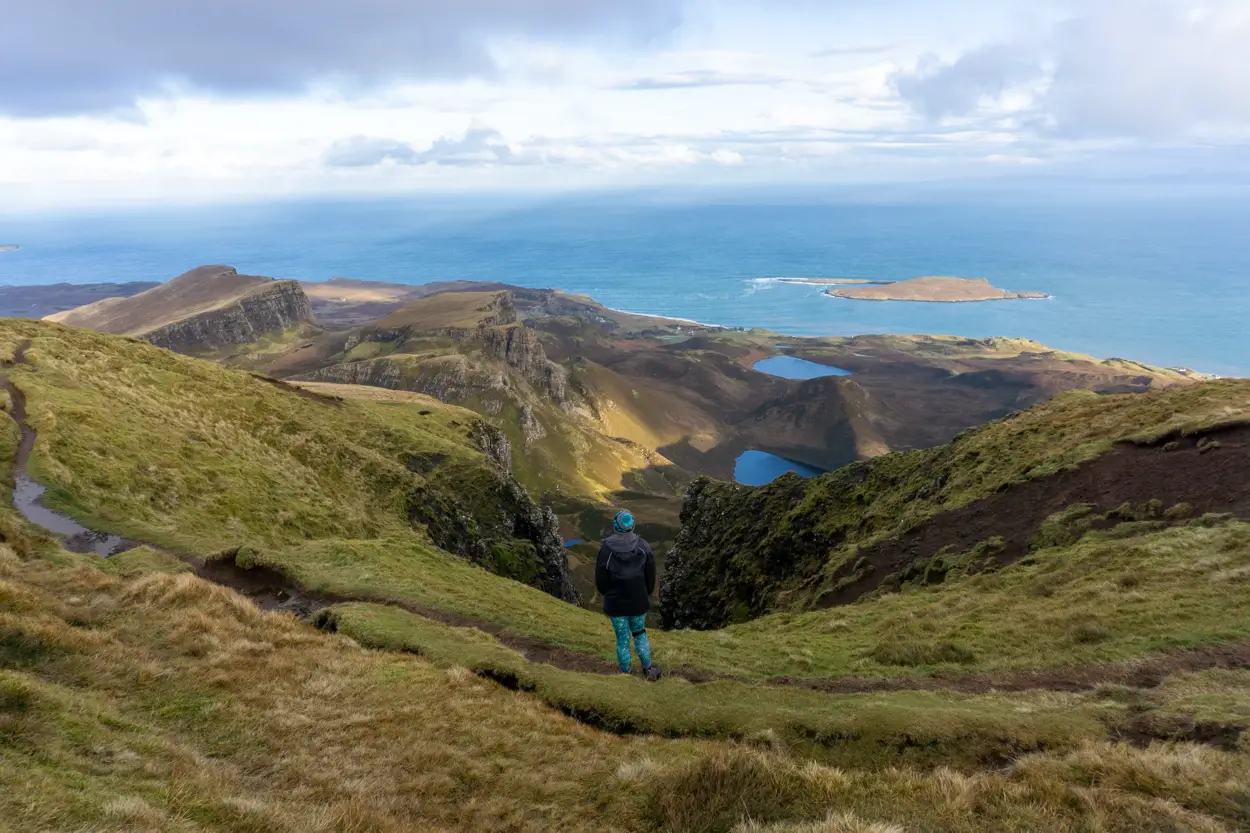
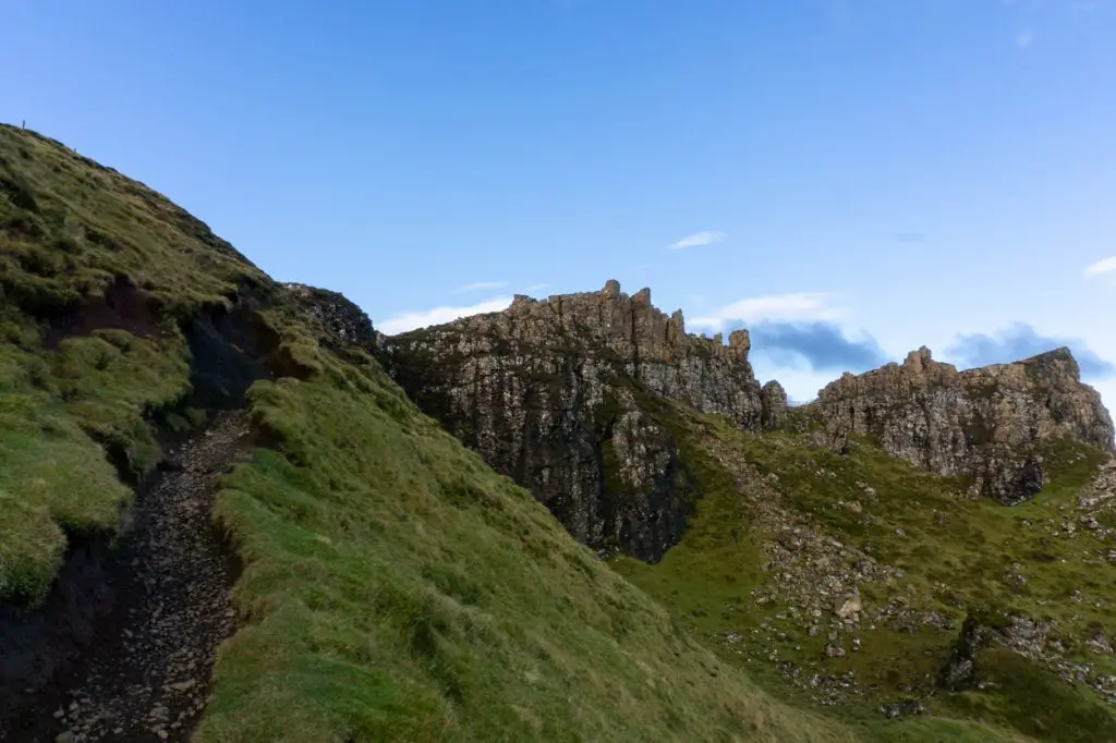
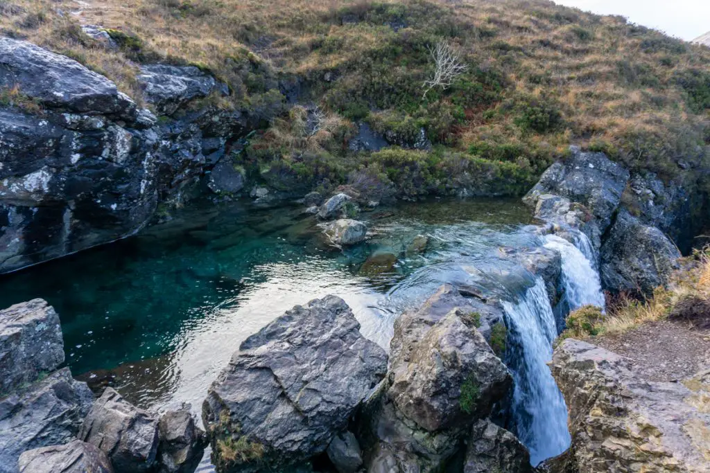
1. The Quiraing
- Length: 6.5 km / 4 miles
- Duration: 3-4 hours
- Difficulty: Moderate
- Wow factor: ⭐⭐⭐⭐⭐
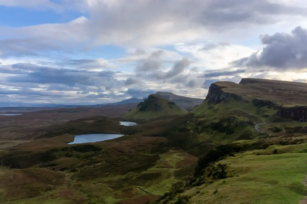
The Quiraing hike is probably the first walk on the Isle of Skye that somebody will recommend to you. There is a good reason for this too, the scenery is some of the best that you will see on the island!
The conveniently located car park means that you only have to walk to the trailhead to see some of the incredible landscape, however, you should not waste the opportunity to do the full circuit through Great Britain’s largest landslip.
The path here is easy to follow and well-beaten from the thousands of feet that have trodden before. You will need decent hiking boots to tackle the steep descent at the end of the trail. I would also recommend walking poles as well as it can be slippery when wet!
How to get there: As the Quiraing is one of the most popular circular hikes on the island, you can simply enter ‘Quiraing car park’ into your SatNav to direct you to the parking area. This is located on the Staffin – Uig road.
Nearby accommodation: Flodigarry Hotel
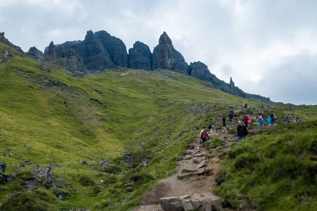
2. Old Man of Storr
- Length: 4.5 km / 2.75 miles
- Duration: 1.5 – 2 hours
- Difficulty: Moderate
- Wow factor: ⭐⭐⭐⭐
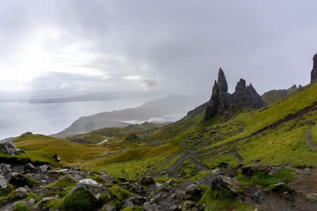
Located along the iconic Trotternish Loop, the Old Man of Storr is one of the Isle of Skye’s most popular walks. Considering how short the path is, it is more demanding than you would expect, especially up to the second viewpoint. The steep, muddy terrain can prove a challenge in all but the best of weather.
As one of the island’s most famous attractions, the trail can get crowded, especially in the summer months. As a result, the Old Man of Storr hike is definitely best tackled first thing in the morning or around sunset (which can be as late as 11 pm in the summer)!
The view over the surrounding landscape is unforgettable and this scenery has appeared in a number of famous movie productions including The Wicker Man and Prometheus.
How to get there: Storr is visible on a clear day from Portree, simply head north out of the town and follow the signs. The main Storr car park is marked on most maps. Although there is a cost to park there, the money is poured back into maintaining the trail.
Nearby accommodation: Storr Apartments
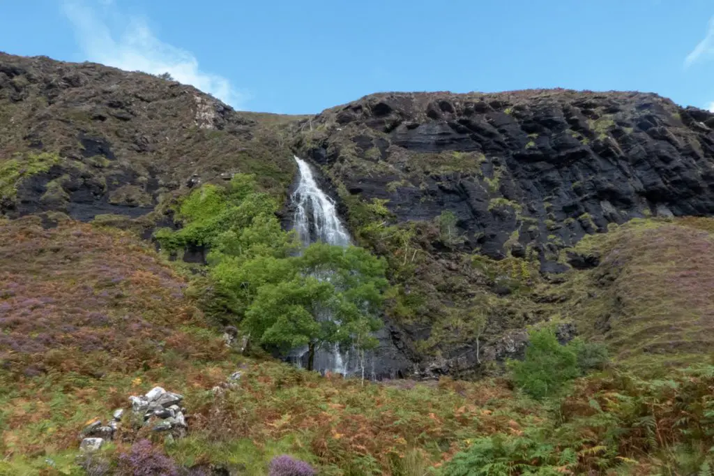
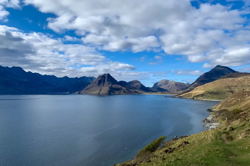
3. Boreraig and Suisnish
- Length: 16.5 km / 10.25 miles
- Duration: 5-6 hours
- Difficulty: Moderate
- Wow factor: ⭐⭐⭐

One of the longer hikes on the Isle of Skye is this beautiful trail that goes through the deserted villages of Boreraig and Suisnish. The trail itself is fairly easy for the majority of the way, however, there are boggy sections that can make the route a little tricky. Make sure you wear sensible footwear.
Although the path is visually stunning, this hike makes the list because of its historical importance. The trail passes through two villages that fell victim to the Highland Clearances. These occurred during the mid to late 18th century and saw the forced eviction of thousands of locals to make way for landowner’s livestock. Estimates indicate that around 15,000 people were ousted from their homes over ten years and many were even left to die.
The ruined houses which remain on the trail are pretty eerie and because the structures are still so intact, it is easy to get lost in your imagination. When you hike this trail, spare a minute to think about what happened to the people here.
Whilst this walk is a moving experience in many ways, it also showcases some spectacular scenery, including the cliffs of Càrn Dearg (keep your eyes peeled for golden eagles) and the beautiful Loch Eishort. There is also a stunning waterfall on the cliff which is very impressive after rain.
How to get there: Parking is opposite the ruined church of Cill Chriosd which is located on Strath Suardal. The church can be entered into Google Maps for location and stands right on the roadside. Be aware that there is only room for a few cars, so you are advised to do this hike out of season or arrive early.
Nearby accommodation: Broadford Hotel
4. Loch Eynort and Glenbrittle
- Length: 16 km / 10 miles
- Duration: 4-5 hours
- Difficulty: Easy
- Wow factor: ⭐⭐
This is one of my favourite Isle of Skye walks. Although the route is mostly forested and some prefer more dramatic views, the trail is usually very quiet, even in the middle of summer. Even though it is a lengthy hike, the walk itself is easy enough, with only a couple of steep uphills.
Intrepid hikers looking to extend this trail can follow the sign labelled ‘Link Loop’. The trail on the right goes down to Glenbrittle, where you can enjoy a dip in the sea before retracing your tracks and rejoining the trail at the same point. It is worth noting them this track down is very steep and should not be attempted in bad weather.
The main trail weaves close to the Fairy Pools and you can see the crowds of people through the trees as you pass by. This makes the solitude of the path even more special. Keep an eye out for sea eagles soaring overhead, I have seen them around this area countless times.
How to get there: You can either park at the fairy pools car park or head further up the same road into a small forested car parking area. There is also parking for two or three cars at the entrance to Loch Eynort.
Nearby accommodation: Skyewalker Hostel
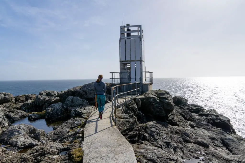
5. Neist Point
- Length: 3km / 1.75 miles
- Duration: 1-2 hours
- Difficulty: Moderate
- Wow factor: ⭐⭐⭐
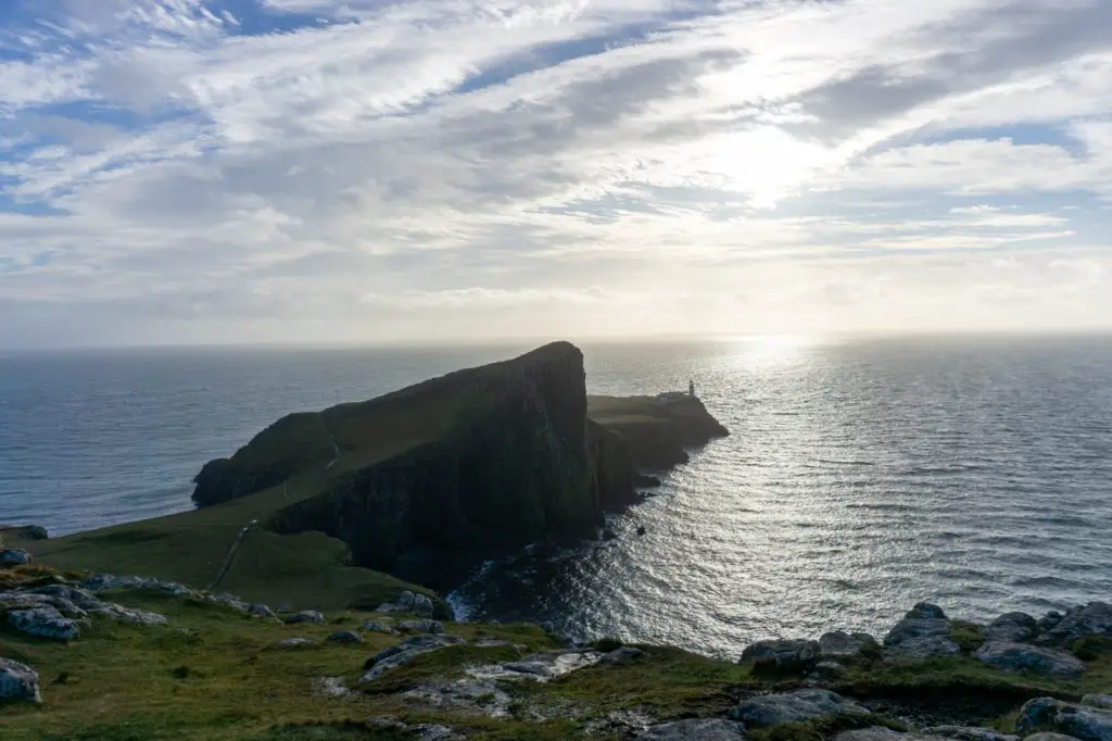
The lighthouse located at Neist Point marks the furthest westerly point of mainland Scotland and offers spectacular views of the surrounding cliffs.
The path itself is clear and easy to follow, although very steep at times. There is a handrail for the majority of the descent which makes this trail a little easier. It is not advised to visit Neist Point in severe winds, although it makes for a wild experience!
It is worth wandering around the grounds of the lighthouse but sitting and enjoying the scenery is also a lovely way to pass the time. This is one of the best areas on the island to see large sea mammals, including pods of dolphins and Minke whales in the summer.
The best time to visit Neist Point lighthouse is early in the morning or late in the evening. The site can get very crowded during the summer months and visiting at these times allows for more privacy and fewer people.
How to get there: There is no public transport that goes to Neist Point so you will need to travel by car or as part of an organised tour. Any SatNav will be able to take you to the parking area but plan ahead in the summer months as these spaces fill very quickly.
Nearby accommodation: Glendale View
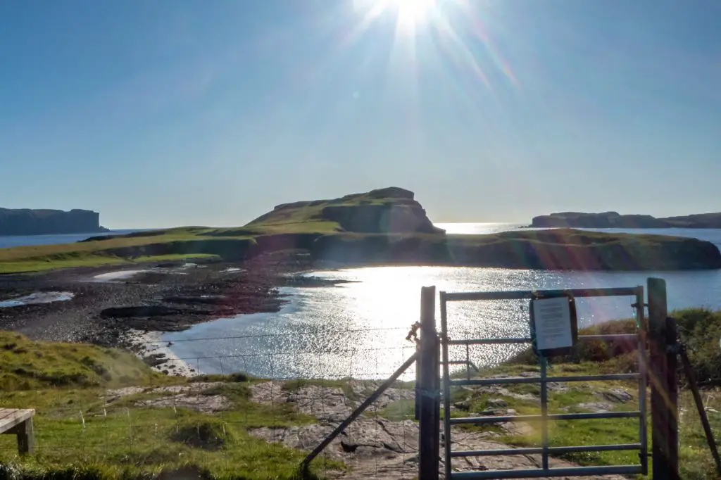
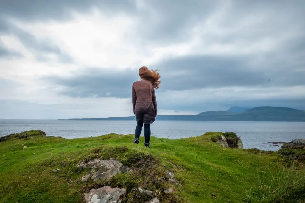
6. Oronsay Tidal Island
- Length: 5 km / 3 miles
- Duration: 2-3 hours
- Difficulty: Easy
- Wow factor: ⭐⭐
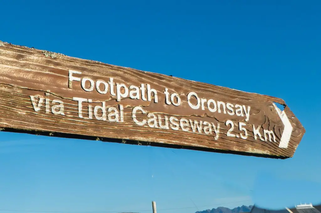
Arguably one of the most overlooked walks on the Isle of Skye is that of Oronsay Tidal Island. It is a short hike but one that easily makes it onto this list. At low tide, you can walk straight out onto the island and take in the views of MacLeod’s Maidens as well as the islands of the Outer Hebrides.
Make sure you check the tide times in advance or you could end up stranded! Saying that, Oronsay is the perfect spot for an overnight adventure and it is virtually guaranteed that you won’t share the island with anyone, except the few resident sheep. Be aware that there is a vertical cliff face so don’t stray too close to the edge.
The hike itself is easy, with only a couple of boggy areas to contend with. In fact, the worst part of this walk is probably passing by the large cows kept in the field close to the start point. Always be careful when walking near cattle and don’t let your dog worry the animals.
How to get there: The start point of this hike is located in Ullinish and ‘Path to Oronsay’ is signed off of the main road. There is a decent-sized parking area close to a kissing gate. The path is well signed to lead you onto the island but the hiking trails disappear once you reach Oronsay. This isn’t a bad thing though, use it as an opportunity to explore the island as you please, without a fixed plan.
Nearby accommodation: Ornum Self Catering Cottage
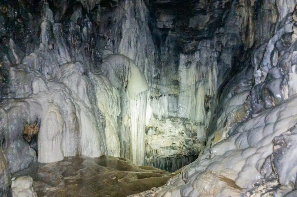
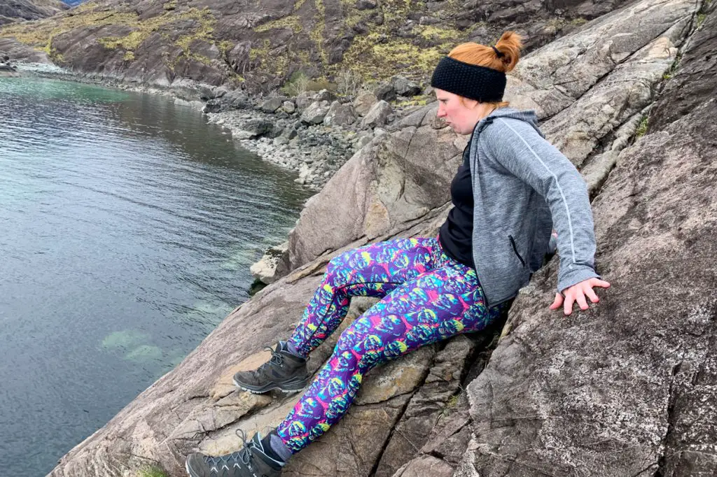
7. Spar Cave
- Length: 0.75 km / 0.5 miles
- Duration: 2 hours
- Difficulty: Moderate
- Wow factor: ⭐⭐⭐⭐

A true hidden gem on Skye is the tide-dependent Spar Cave, located near Elgol. A visit to this tidal cave involves a little bit of planning but the experience is well worth the effort.
The hike begins at the red phone box in Glasnakille. From there, follow the road until you come to a gate next to an abandoned house. From here, there will be a sheep trail through the fields which heads towards the coast. As the path descends you’ll make your way down to the boulders, which mark the meeting of the land with the sea.
You will need to continue around a couple of cliff faces before you find the gorge that will take you to Spar Cave. If timed wrong, this area is completely inaccessible so you must check the tide times beforehand.
Spar Cave is located on the left. It is pitch black so you will need a decent head torch to explore. There are some icy cold pools inside where it is possible to swim, although I am not sure I would recommend this. The water is freezing!
How to get there: Enter Spar Cave into your SatNav and park close to the red phone box. There is limited parking but owing to the secret nature of the cave, it is unlikely that you will struggle too much when searching for somewhere to park.
Nearby accommodation: Tigh Phadraig at Marys Thatched Cottages
Looking for a detailed walking guide for Skye? Look no further than ‘’, written by Walk Highlands legends Helen and Paul Webster [AD – PR product]. This pocket-sized guidebook details 20 of the best day hikes on the island, from easy beginner circuits to advanced hillwalking challenges.
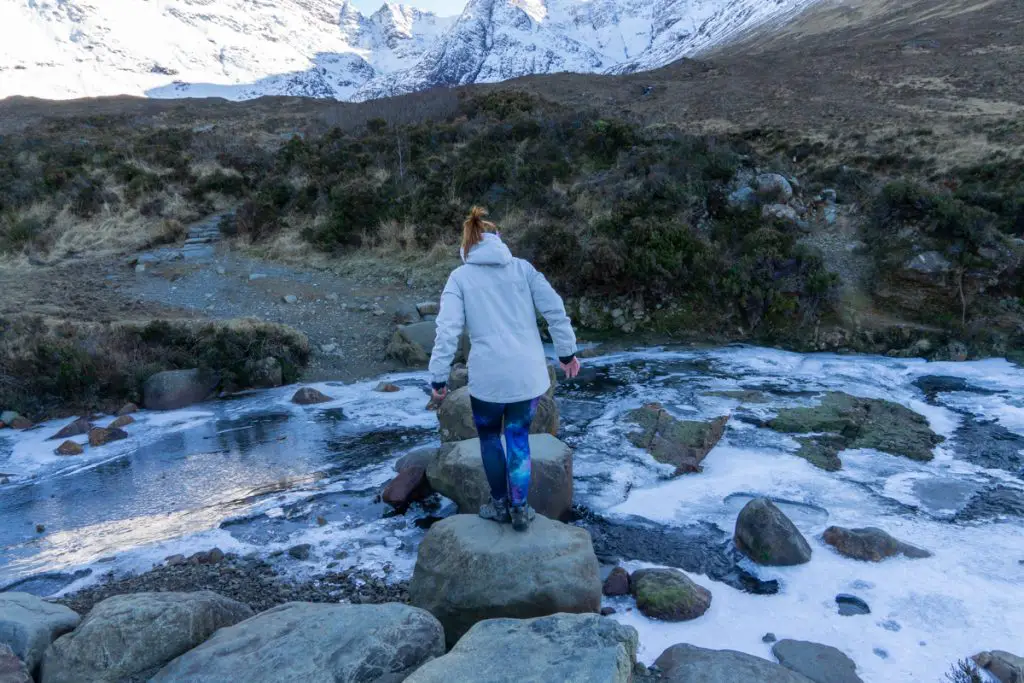
8. Bruach na Fríthe
- Length: 13.75km / 8.5 miles
- Duration: 5-7 hours
- Difficulty: Challenging
- Wow factor: ⭐⭐⭐⭐⭐
Offering some of the best views that you can get from any of the hikes on the Isle of Skye, Bruach na Fríthe is a must for walkers eager to bag their first Munro in the striking Cuillin Mountain range. For those not experienced in hillwalking, the route is challenging. A wee bit of scrambling is required, as is scree hiking.
Although this hike is a nice introduction to the Cuillin Ridge, you should not attempt this route in poor visibility as it is easy to lose the trail. If you’re planning to head high into the hills, you should always tell somebody where you are going beforehand and carry a few supplies in case you get into difficulty. A guidebook or map is advised for this hike.
An underrated highlight of the trail is the beautiful walk alongside the Allt Dearg Mór River at the beginning of the hike. If it is a hot day, bring your swimsuit and take a dip in the pools there. In my opinion, they rival that of the fairy pools and there are a fraction of the crowds!
If you want to head into the hill but find the idea of scrambling and scree a bit daunting, consider instead hiking to Coire Lagan, a beginner-friendly trail up into the heart of the Cuillin.
How to get there: Head past the Sligachan Bridge in the direction of Carbost. Around the corner, you will see a roadside lay-by where it is possible to park. From here, take the track signposted ‘Footpath to Glen Brittle’.
Nearby accommodation: Sligachan Hotel
9. Dunscaith Castle
- Length: 2 km / 1.25 miles
- Duration: 40 minutes
- Difficulty: Easy
- Wow factor: ⭐⭐⭐⭐
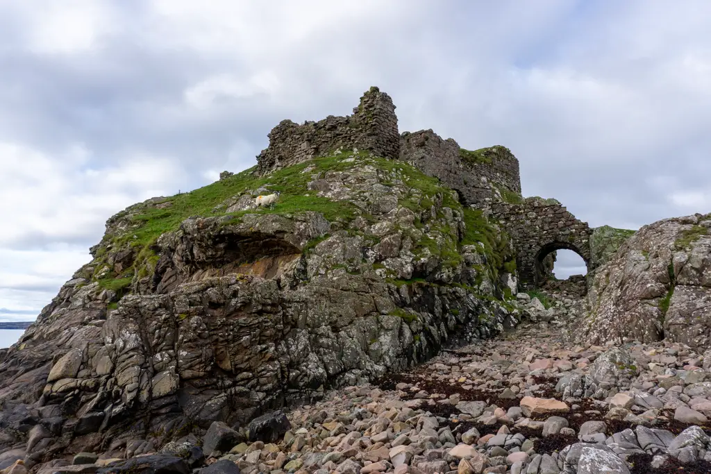
Even though the hike to Dunscaith Castle is short, it showcases amazing views, both of the ruined fortress and the incredible Cullin Mountains. Unlike some of the other castles on the Isle of Skye, Dunscaith is free to enter too, making it a cheap, nice walk for families.
The ruined castle stands on a rock above Loch Eishort and is a playground for any history buff.
Dunscaith remains remarkably intact, however, the drawbridge has long been missing. If you’re brave enough to cross the gaping cavity where the bridge once stood, you’ll get the opportunity to be a child again ruling your very own castle!
The trail itself is easy, albeit slightly boggy in places. From the road, the structure is easy to find, simply head out to the large rocky outcrop which looks like it could once have been a powerful castle.
How to get there: Head to Tokavaig Bay where there are a couple of parking spaces close to the cattle grid.
Nearby accommodation: Comraich
10. Loch Coruisk to Elgol
- Length: 9km / 5.5 miles
- Duration: 5-6 hours
- Difficulty: Challenging
- Wow factor: ⭐⭐⭐⭐⭐
Believe me when I say, this is a hike not for the faint of heart! Beginning in Loch Coruisk and heading to Elgol, it doesn’t cover a huge distance but it is sure to get those muscles working!
As an out and back hike, this would be a very long walk so it is recommended to make only the return journey on foot. For the outbound trip, jump on one of the many boat trips to Loch Coruisk and then hike back. There are a variety of boat trips to the loch, including a ‘one way in’ trip specifically aimed at wakers.
This trail follows a stunning section of Skye’s coastline, showcasing incredible views of the Cuillin. It should only be attempted for those without a fear of heights, as to complete the hike to Elgol, you will have to tackle the infamous Bad Step.
This section of rock can only be traversed by scrambling which can be very daunting for walkers who prefer to spend the entirety of their hikes on smooth ground. Be very careful if attempting the Bad Step and be aware that return boat trips happen every hour or so if you change your mind!
How to get there: Reserve a place on a boat trip prior to your journey. Once you have secured a spot, drive down to Elgol pier and board the boat from there. I highly recommend Bella Jane boat trips.
Nearby accommodation: Tigh Phadraig at Marys Thatched Cottages
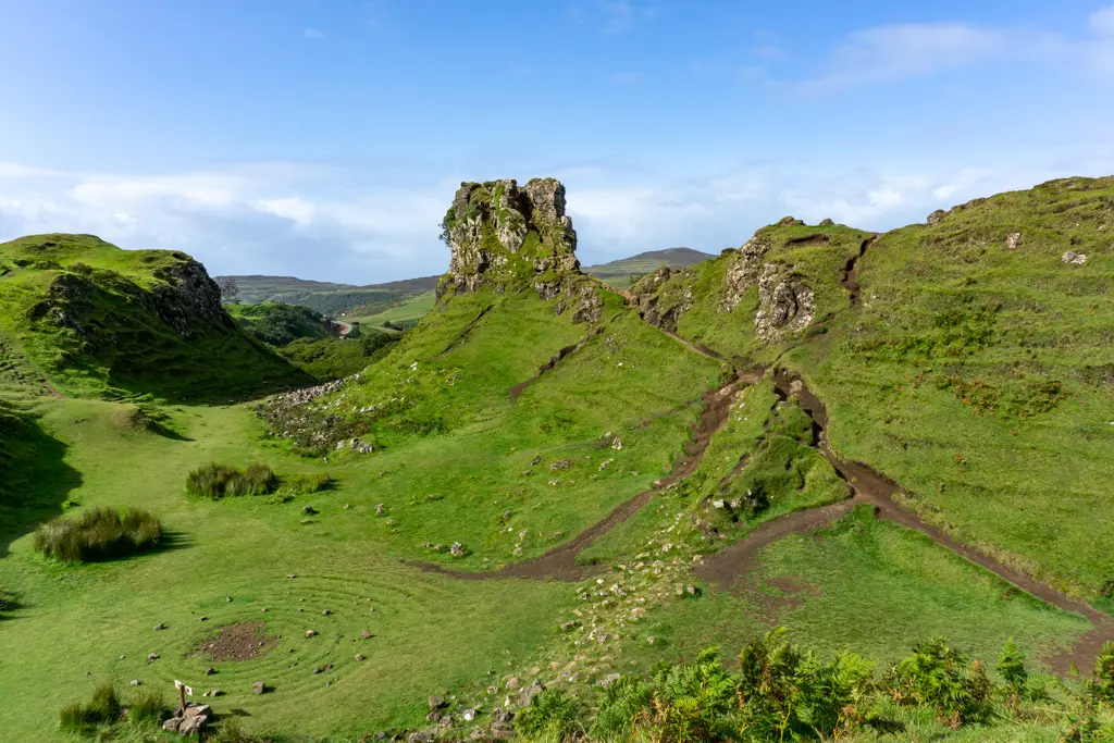
11. Fairy Glen
- Length: 2 km / 1.25 miles
- Duration: 1 hour+
- Difficulty: Easy
- Wow factor: ⭐⭐⭐⭐
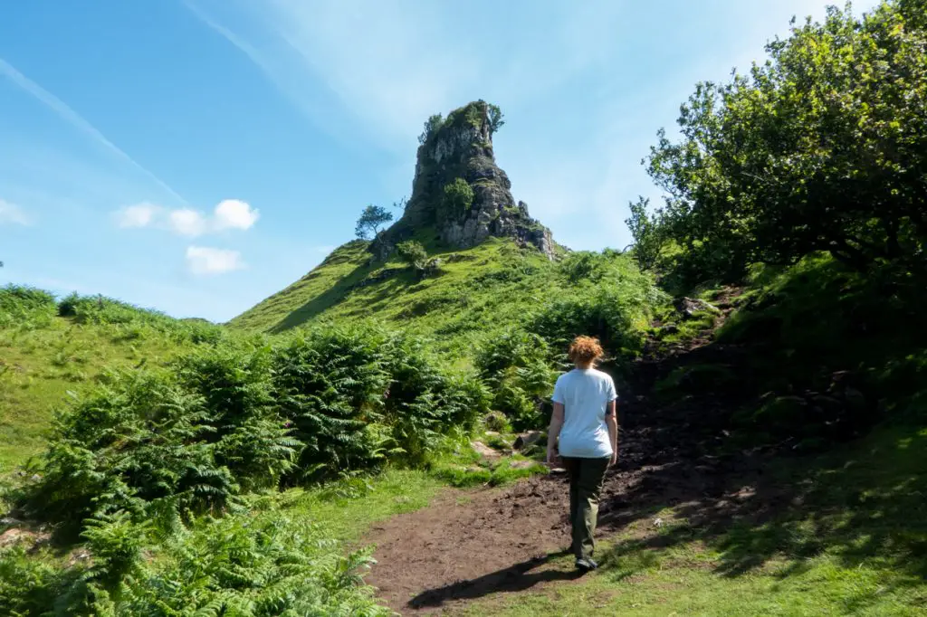
Probably the most magical walk on Skye is this wee jaunt around the Fairy Glen. The landscape immediately conjures up images of Hobbiton and you could even be forgiven for thinking you spotted a fairytale creature out of the corner of your eye!
The Fairy Glen hike starts as soon as the landscape comes into view. There is a path on the left side of the road that you can follow for views of the surrounding conical hills. Continue to make your way towards Castle Ewen, the rocky tower which stands atop the main hill.
The trail will lead you into a beautiful grassy area with a charming spiral. This area suffers hugely from over-tourism and there have been problems with visitors stacking stones on the spiral, damaging the landscape. Signs have been erected to warn visitors against doing this.
Ascend to the top of the rocky mound, also known as Castle Ewen, for stunning views of the surrounding area. There is a surprisingly large platform at the top but do be aware that this can get tight when there are lots of people. Return to the car park by following the path on the left side of the loch.
How to get there: Head in the direction of Uig. You will need to take the side road off of the A87 close to the Uig Hotel. From there, follow the road and you will see the Fairy Glen once it comes into view. There is a small car park here. Do not use the passing spaces to leave your car. It causes extreme congestion. Instead, aim to visit early in the morning to avoid the bulk of the crowds.
Nearby accommodation: The Beach House, Bed and Breakfast
12. Fairy Pools
- Length: 2.4 km / 1.5 miles
- Duration: 40 minutes
- Difficulty: Easy
- Wow factor: ⭐⭐⭐⭐
After images of the Fairy Pools went viral on Instagram, visitor numbers boomed. Even though the social media buzz has now died down, it remains one of the most popular attractions on the islands.
There are a number of stepping stones that have to be crossed at the start of the trail. After heavy rainfall, these rocks can be slippery, if not completely submerged, and the trail gets very muddy. Visitors are advised to wear hiking boots to do this trail. Due to the recent installation of a bridge, this trail is now more accessible.
The highlight of visiting the Fairy Pools is the crystal clear water which attracts wild swimmers from all over. Be warned, the pools are very cold year-round so you’ll need to be made of strong stuff if you want to take the plunge! It is also important to remember that the underwater current can be dangerous so take care.
Also read: Visiting Isle of Skye in winter.
How to get there: As one of the most popular places on the island, the Fairy Pools are easy to find and your SatNav is almost certain to know the way. They are located up from the road to Glenbrittle. There is designated paid parking for the pools across the road.
Nearby accommodation: Holiday Home Eynort
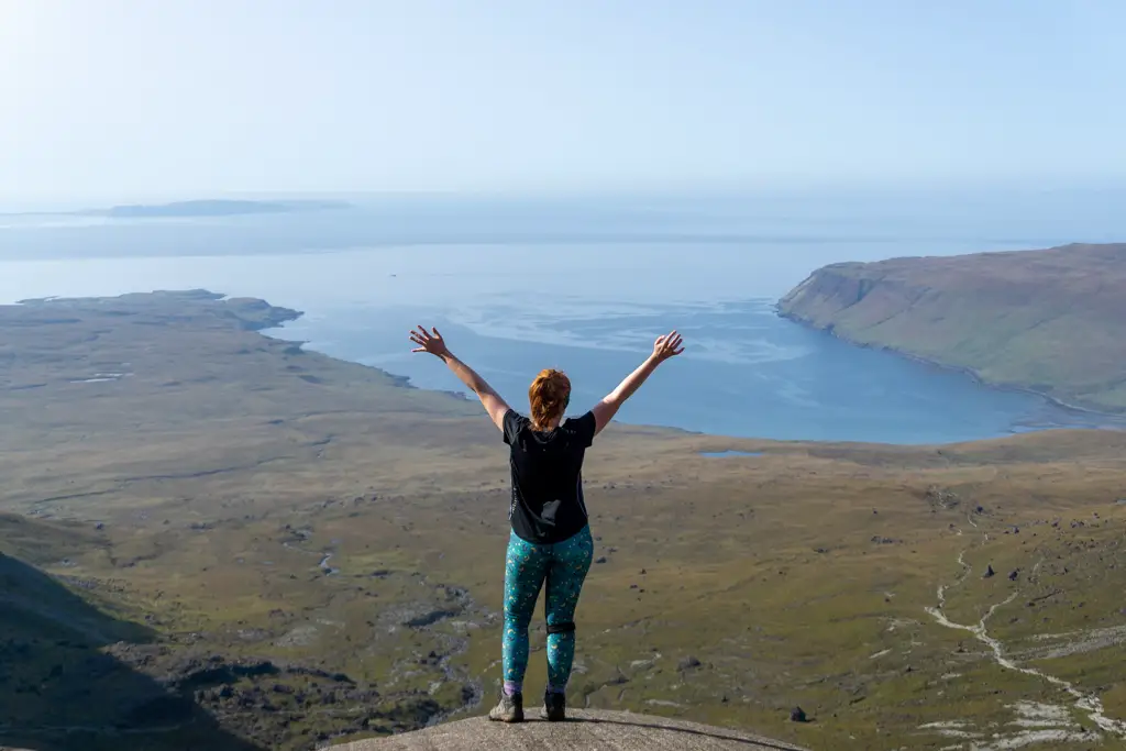
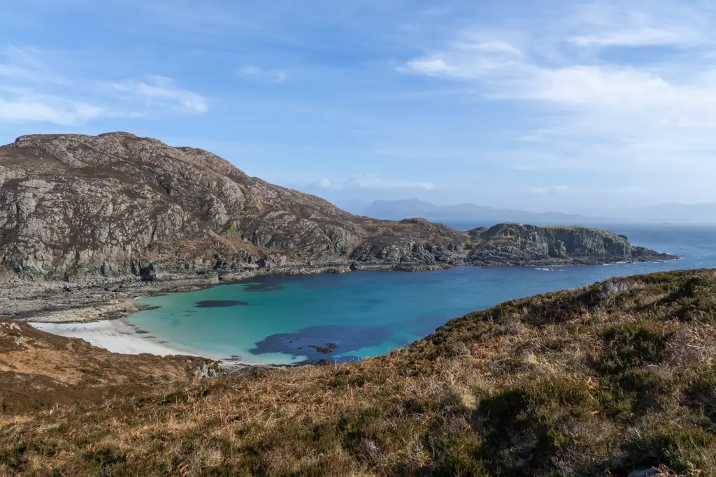
13. Point of Sleat
- Length: 8.5 km / 5.25 miles
- Duration: 3-4 hours
- Difficulty: Moderate
- Wow factor: ⭐⭐⭐⭐
In my opinion, this is definitely one of the best walks on the Isle of Skye. Not so much for the final destination but the incredible beach en route. Camas Daraichis one of Skye’s hidden gems and looks like it has fallen straight out of the Mediterranean. Really!
The walk to the Point of Sleat, the southernmost point of Skye, is marked by a lighthouse. The trail is pretty easy in terms of terrain and the ability level required. Arguably, the most daunting thing is passing the many cows en route!
I definitely recommend allowing some time to chill at Camas Daraich when you arrive. Although not the most famous of the beaches on the Isle of Skye, this beguiling bay feels secluded and private. Its sandy shores and sparkling turquoise water also look like they’ve fallen straight out of a postcard.
When it comes to beaches, Skye is often overshadowed by its neighbour Harris so this is one place you shouldn’t miss!
How to get there: The only way to reach the start point of the hike is to drive. Park at the end of the road in Sleat (around 10 spaces) and go through the wooden gate. Be careful that you do not block any vehicles.
Nearby accommodation: The Inn @ Aird a’ Bhasair
14. Brothers’ Point
- Length: 3.5 km / 2.25 miles
- Duration: 2 hours
- Difficulty: Moderate
- Wow factor: ⭐⭐⭐⭐
If there is anything that the Isle of Skye does well, it is imposing and ominous headlands. Brothers’ Point is no exception. Located in the Trotternish peninsula, this coastal hike will make you feel like you’re walking to the end of the world.
Although it looks a bit daunting, the trail is actually not as sketchy as it looks (in most places). There are some steep drops and the wind can get wild so only attempt this hike in good weather and be careful on cliff edges.
As the headland juts right into the sea, Brothers’ Point is an incredible destination to look for wildlife. Both marine animals and seabirds frequent the area. On a clear day, it is also possible to see all the way out to Mealt Falls and Kilt Rock!
How to get there: There is no organised parking at Brothers’ Point. The only option nearby is a small lay-by located along the A855. This will fill up quickly during peak season, so arrive early to ensure you grab a space.
Nearby accommodation: Chasing The Moon Skye
15. The Skye Trail
- Length: 128 km / 80 miles
- Duration: 7 days
- Difficulty: Challenging
- Wow factor: ⭐⭐⭐⭐⭐
The Skye Trail is a long-distance hike, traditionally walked from North to South. It is recommended for experienced walkers only, owing to the need to navigate independently and tackle challenging terrain.
The path is not signed by waymarkers and at times, the trail is next to nonexistent. It is very difficult to complete during winter and as such, should only be attempted during the better weather months.
If you brave the hike, it will take you through some of Skye’s best scenery. Beginning at the most northerly tip in Skye, Rubha Hunish (Uig), the trail takes you along the Trotternish Ridge and showcases the scenery of the Quiraing and the Old Man of Storr.
The route will lead you through the island capital Portree, through to Sligachan via the Braes where you can get an excellent view of the Black Cuillin and further onto Elgol. The route finishes by following the old railroad route into Broadford.
Those walking the Skye Trail will get to see many of the island’s highlights en route, as some of the best walks on this list are incorporated into this journey. There are a couple of bothies that you can stay in on the way, located at Rubha Hunish and Camasunary Bay, however, most people who attempt the trail will rough camp.
How to get there: Buses leave for Uig from Portree (the weekend schedule is reduced majorly on Saturdays and no buses on Sunday). You will need to disembark at the Duntulm Hotel. Although you can drive to the start point, the only parking close by is at the Duntulm Hotel. I would advise finding somewhere else to park and then heading to the area via public transport.
What are your favourite Isle of Skye walks?
Hi can you recommend a map that covers these walks plus spar cave please
Hi Janice,
Thanks for reading! 🙂 Unfortunately, I don’t have a map that has all of these walks. However, they are all on Walk Highlands with detailed route descriptions. Have a great trip to Skye!