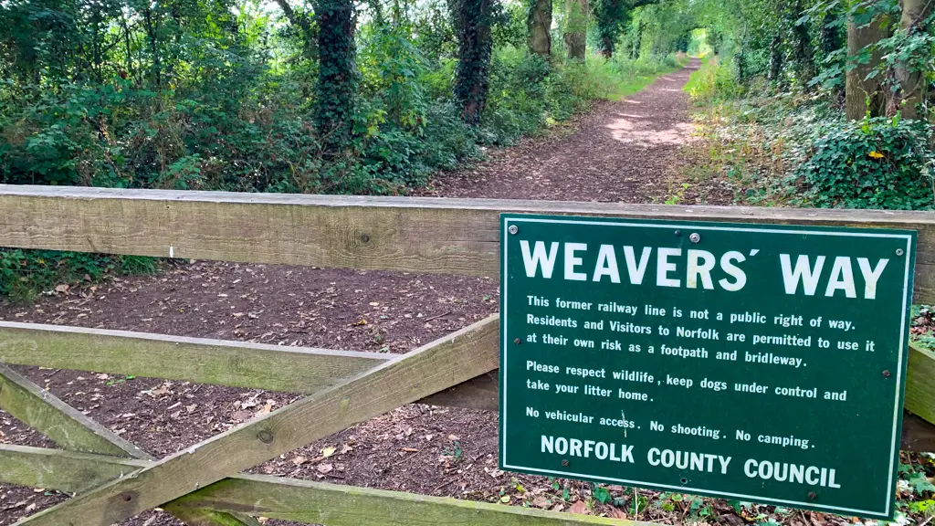
Weavers’ Way is a long-distance trail stretching 61 miles (98 km) through Norfolk, England. It begins in Cromer and finishes in Great Yarmouth, showcasing some of the county’s most stunning scenery along the route.
The trail is so named after the weaving industry which thrived during the Middle Ages in the areas around North Walsham. It is a great first long-distance trail for aspiring hikers, mainly owing to the flat terrain and the frequency with which it winds through many of the best seaside towns in Norfolk. These spots are great places to use public facilities and stock up on blister plasters!
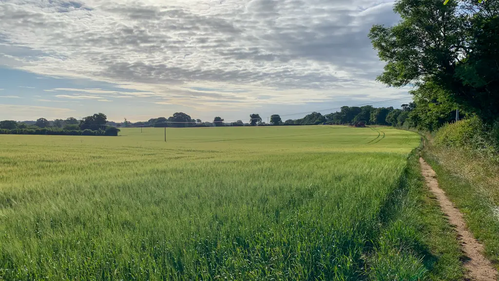
Norfolk is well-known for being one of the flattest places in the country but luckily this doesn’t mean that the views are lacking. The trail comprises a mix of old railway tracks, wildlife marshes and the stunning Broads National Park.
I recently spent 4 days hiking the trail but this was actually my second attempt after I failed to finish the trek whilst I was training for the French Way of the Camino de Santiago. If you are considering ticking this trail off your list, read on for everything you need to know!
This post contains affiliate links. If you use them, I will receive a small commission at no extra cost to you.
Read more: (opens in new tab)
Hiking Weavers’ Way: Quick Stats!
- Duration: 61 miles
- Walking time: 25-30 hours
- Terrain: Mostly flat
- Difficulty: Easy
- Well-signed: Yes
Weavers’ Way Map
Weavers’ Way Directions
The Weavers Way trail is very well signed throughout, so a physical map is not necessary. Look out for the traditional green and white markers which direct hikers along the trail. There have recently been newer pink trail markers installed too, although these are more frequent during the first couple of stages of the hike from Cromer.
In case you are worried about getting lost, I’d recommend downloading the maps.me app and cross-referencing with the PDF versions of each stage which you can find here. Alternatively, you can use the OS Maps App or View Ranger (both subscription services). Avoid the interactive map – it plays host to a whole manner of trails and is very confusing to interpret.
Weavers’ Way Suggested Itinerary: 4 Days
For hikers looking to take on the full trail in one go, I would recommend the following 4 day itinerary. If you can’t commit to four days walking in a row, Weavers’ Way can be undertaken by doing many shorter day hikes. The trail is very accessible by public transport which makes it very easy to pick up.
Day 1: Cromer to Aylsham – 17 miles
Highlights: Felbrigg Hall, Blickling Hall.
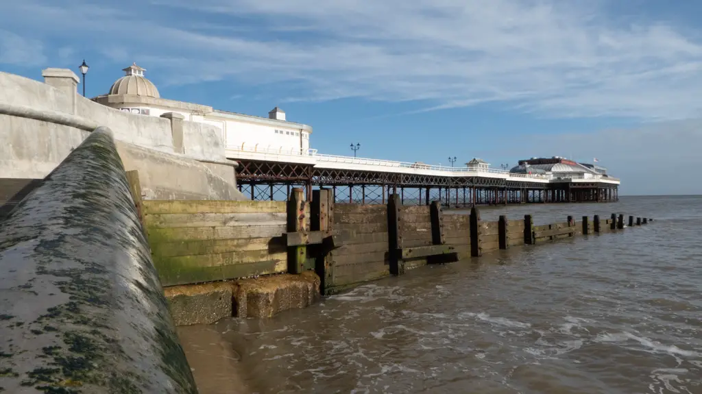
The official start point of the hike is Cromer pier. The first day’s walk comprises a good mix of farm tracks, country lanes and pavements. The National Trust owned Norfolk stately homes of Felbrigg and Blickling are arguably the most notable highlights.
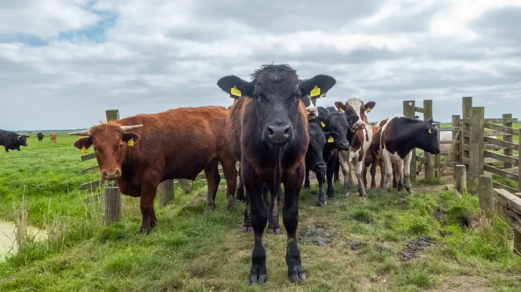
Be aware that some of the tracks will cross fields with cattle in. During our hike across the Blickling Estate, Tim and I had a very scary encounter with a field full of cattle which nearly resulted in us being seriously injured. Stay alert and read more about keeping yourself safe when hiking near livestock.
Suggested accommodation: Tinsmiths House
Day 2: Aylsham to Stalham – 14 miles
Highlights: Honing Station, North Walsham & Dilham Canal.
Whilst not as showy in terms of scenery as day one, the second day on Weavers’ Way offers varied but easygoing terrain. As well as rural paths, country lanes and farm tracks, there is also a large amount of walking alongside a disused railway.
North Walsham is at pretty much the halfway point of this stage and provides a good opportunity to stock up on supplies as well as to use the public facilities. The stretch from North Walsham into Stalham can be tough on the soles of the feet so bring a small pot of tiger balm to rub them down with later. You’ll be sure to thank yourself the following day!
Suggested accommodation: The Harnser
Day 3: Stalham to Acle – 18 miles
Highlights: Sutton Mill, Hickling Broad and Marshes, Repps.
Although the first part of the journey out of Stalham is not very scenic, this quickly changes once you reach Sutton. The day’s walking is a mix of pavements country lanes and farm tracks.
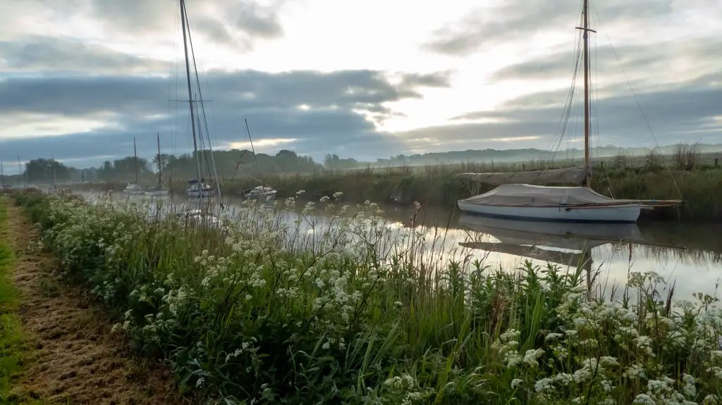
Hickling Broad signifies a change in terrain as from this point onwards, the paths are all waterside. Keep your eyes peeled for the chances to see some incredible birdlife, including Marsh Harriers, Swallowtails and the Common Crane.
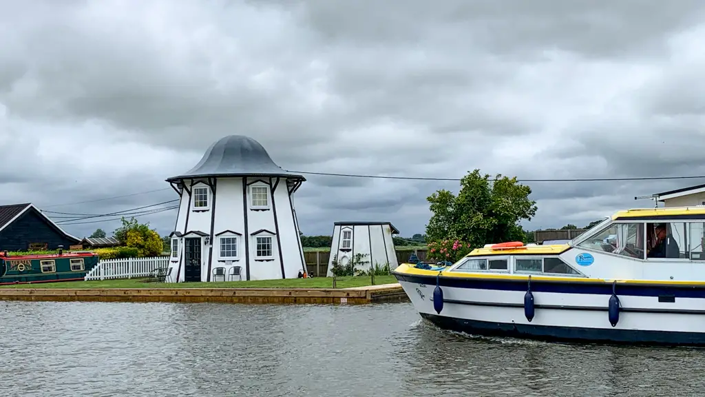
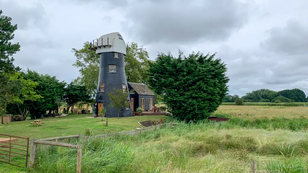
As the longest day on the trail, this stretch can be tough, however, in my opinion, it showcases some of the best scenery from the whole trek. When passing through Repps, make sure to take your time. The picturesque holiday homes and converted windmill are fantastic examples of some of the quirky accommodation available in Norfolk.
Suggested accommodation: Travelodge Great Yarmouth Acle
Day 4: Acle to Great Yarmouth – 12 miles
Highlights: Halvergate Marshes, Berney Arms Mill, Berney Arms Railway Station.
The home stretch is easy enough although it can be grim in bad weather. The first half of the day will be spent crossing boggy cattle fields (not good if you have already had a traumatising experience with cows!) and the second follows the river until you reach Breydon Water.
Most of the paths are farm tracks and there are some beautiful windmills (both functioning and not-so-functioning) en route. Look out for the Berney Arms railway station, one of the most remote in the country. It is accessible only by foot, rail or boat.
The route officially finishes at the Great Yarmouth Railway Station, however, the town itself is well worth a look. Whilst it is most famously known for the Britannia Pier and the flashing lights of the arcades, you can get a mean post-trek fry up from one of the many cafes along the seafront!
Suggested accommodation: Hotel Ocean

Getting to Weavers’ Way
Weavers’ Way can either be walked from Cromer to Great Yarmouth (this is the traditional route) or in reverse. Both the start and endpoints have good public transport links and arranging your journey has never been easier.
There are major train stations in Cromer, North Walsham and Great Yarmouth. However, Aylsham is served by the Bure Valley Railway which runs to Wroxham and the Berney Arms station also serves upon request. The closest city to the route is Norwich where is it possible to catch a train to one of the major stations listed above.
Those starting in Cromer can make their way via bus from many of the surrounding villages. Sanders Coaches operate in much of the North Norfolk area, although depending on where you intend to travel between, pick-ups might be sparse, especially on Sundays.
Facilities on Weavers’ Way
This is a great long-distance trail for beginners because so much of the route weaves in and out of very well stocked towns. Cromer, Aylsham, North Walsham, Stalham, Acle and Great Yarmouth all have access to public facilities and supermarkets. If you can spare the time, I’d definitely recommend stopping in one of the local pubs for a pint, after all, you’ll deserve a reward for all that walking!
Camping on Weavers’ Way
Whilst the 4 day itinerary listed above does include suggested accommodation, it is also possible to wild camp the Weavers’ Way route. This is what we did and we had very few problems. However, if you are planning to wild camp, you may want to overshoot the suggested stage breakdowns to make sure you are out of town.
I would recommend taking as much dry food as possible and picking up more on the way. Even if you didn’t want to divert from the path too much, Weavers’ Way heads straight through the middle of Cromer, North Walsham and Stalham so it would be easy to pick up camping supplies en route!
As with any kind of wild camping, always follow the leave no trace policies and respect both the residents and the environment. If you do decide to wild camp, be aware that you may need to head away from the path to find a more secluded spot.

Cycling Weavers’ Way
Much of the Weavers’ Way route is off-limits for cyclists. However, there is work ongoing to make the trail more accessible for bikes. Currently, you can cycle the 14-mile section between Aylsham and Stalham.
Where to Next?
Weavers’ Way joins with the Norfolk Coast Path at Cromer and also Wherrymans Way and Angles Way in Great Yarmouth.
When Angles Way and the Norfolk Coast Path are combined with Peddars Way, they make a loop around Norfolk. Why not take on another trail and lengthen your adventure?!
Have you hiked Weavers’ Way?

Great insight into the route and logistics.
Little curious how easy you found it finding secluded wild camping spots on the route. I struggle a bit with bivvy spots when I did the route the other weekend.
Thanks for your comment!
I’m someone who wild camps regularly and I’ll admit Norfolk isn’t the best place for it, with it being so flat! Generally, it wasn’t too much of a struggle, provided we headed away from the trail and overshot the main towns. We did have to pitch up in the odd less than ideal place (like the corner of a field) but made sure we set up after dark and were away before the sun rose. Hope you had a great hike!
I’m going to be walking The Weavers Way in the middle of June & I can’t wait😊
Have an amazing hike Rob! 🙂
Thanks Sheree, any tips/advice?
All the normal advice for long-distance hiking applies, listen to your body, stretch before you start and when you finish for the day. Make sure to leave no trace if you’re camping. I’d definitely advise carrying a tick-removal tool too as well! Enjoy!